Grove : GPS
De Wikidebrouillard.
Sommaire |
Introduction
This Grove - GPS module is a cost-efficient and field-programmable gadget armed with a U-blox 6 compatible GPS module E-1612-UB and serial communication configuration. It features a 50-channel U-blox 5 positioning engine which boasts a Time-To-First-Fix(TTFF) under 1 second. The sensitivity of tracking and acquisition both reach up to -160dBm, making it a great choice for personal navigation projects and location services, as well as an outstanding one among products of the same price class.
Model:SEN10752P

Features
- Grove compatible interface
- Supports NMEA and U-Blox 6 protocols.
- Low power consumption
- Baud rates can configurable
Specification
| Item | Min | Typical | Max | Unit |
|---|---|---|---|---|
| Voltage | 4.75 | 5.0 | 5.25 | VDC |
| Sensitivity | -160 | dBm | ||
| Baud Rate | 4800 | - | 57600 | Baud |
| Operating temperature | -40 | - | 85 | ℃ |
Application Ideas
- Object Locating and Tracking
- Navigation
Usage
This sample simply reads from the GPS using software serial and sends it back out on the serial port.
- Connect the Grove-GPS to Digital I/O 2 on the Grove - Base Shield using a Grove Universal 4 pin cable.
- Upload below Code. Please click here if you do not know how to upload.
// link between the computer and the SoftSerial Shield
//at 9600 bps 8-N-1
//Computer is connected to Hardware UART
//SoftSerial Shield is connected to the Software UART:D2&D3

#include <SoftwareSerial.h>

SoftwareSerial SoftSerial(2, 3);
unsigned char buffer[64]; // buffer array for data recieve over serial port
int count=0;     // counter for buffer array
void setup()
{
  SoftSerial.begin(9600);               // the SoftSerial baud rate
  Serial.begin(9600);             // the Serial port of Arduino baud rate.

}

void loop()
{
  if (SoftSerial.available())              // if date is comming from softwareserial port ==> data is comming from SoftSerial shield
  {
    while(SoftSerial.available())          // reading data into char array
    {
      buffer[count++]=SoftSerial.read();     // writing data into array
      if(count == 64)break;
  }
    Serial.write(buffer,count);            // if no data transmission ends, write buffer to hardware serial port
    clearBufferArray();              // call clearBufferArray function to clear the storaged data from the array
    count = 0;                       // set counter of while loop to zero


  }
  if (Serial.available())            // if data is available on hardwareserial port ==> data is comming from PC or notebook
    SoftSerial.write(Serial.read());       // write it to the SoftSerial shield
}
void clearBufferArray()              // function to clear buffer array
{
  for (int i=0; i<count;i++)
    { buffer[i]=NULL;}                  // clear all index of array with command NULL
}
- Install u-center. Upload the code below to your arduino/seeeduino and then open u-center.
- 1) Click Receiver -> Port and select the COM port that the arduino is using.
- 2) Click Receiver -> Baudrate and make sure 9600 is selected.
- 3) Click View -> Text Console and you should get a window that will stream NMEA data.
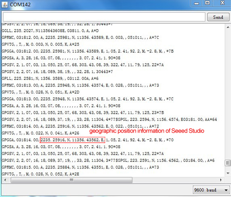
- 4) Open the serial monitor,You can see as show below:

- To View data in Google Earth:
- 1) Click File -> Database Export -> Google Earth KML
- 2) This Should launch Google Earth with the history that was captured by u-center.
- 3) Alternatively, data can be recorded by pressing the red circle on the toolbar which will then ask you where you want to save the record.
- 4) When you have captured enough data, click the black square to stop recording.
- 5) You can then convert the .ubx file generated to KML by using uploading the ubx file to GPSVisualizer
Version Tracker
| Revision | Descriptions | Release |
|---|---|---|
| v0.9b | Initial public release | 03,Oct,2011 |
Resources
- GPS Eagle File
- GPS Schematic(PDF)
- E-1612-UB Datasheet
- U-Blox6 Receiver Description Protocol Spec
- U-Blox u-center GPS evaluation software
Support
If you have questions or other better design ideas, you can go to our forum or wish to discuss.
Crédits
Cette page est la traduction de celle-ci : http://www.seeedstudio.com/wiki/Grove_-_GPS
Traducteurs : machine et bidule - 2013 dans le cadre de Master 2 rédacteur traducteur 2013

